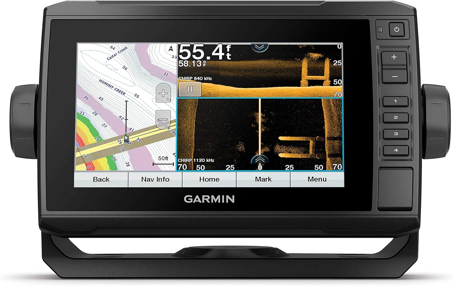
C-MAP Reveal Coastal Charts for Marine GPS Navigation with Shaded Relief, Hi-Res Bathymetry, Vectors, Custom Depth Shading
$318.99
Features
FULL-FEATURED VECTOR CHARTS: Making navigation easy by giving you accurate, up-to-date vector chart detail derived from official Hydrographic Office information.
HIGH-RES BATHY: Helps you identify shallow areas, drop-offs, ledges, holes or humps. Now includes compiled and quality-controlled Genesis detail as part of singular HRB layer.
CUSTOM DEPTH SHADING: Set a clear safety depth, maintain a paper-like view or create your own custom shading.
DYNAMIC RASTER CHARTS: Providing the traditional chart look and feel, coupled with easy access to all objects on the chart.
Details
Experience a whole new dimension of marine GPS navigation with C-MAP Reveal Coastal Charts. With their advanced features and innovative technology, these charts are a game-changer for anglers and divers. One of the standout features is the shaded relief, which brings the world around you to life with 3D rendered land and underwater elevation. Get a clear understanding of the underwater topography, including areas of ultra-high-resolution bathymetric imagery. This level of detail is a game-changer for those looking to catch more fish or explore new diving spots.
Navigation has never been easier thanks to C-MAP Reveal's full-featured vector charts. These charts provide accurate and up-to-date chart detail derived from official Hydrographic Office information, ensuring you have the most reliable navigation data at your fingertips. Whether you're planning a weekend fishing trip or a coastal voyage, trust in the power of C-MAP Reveal to guide you safely to your destination.
Identifying hidden hazards in the water has never been easier thanks to C-MAP Reveal's high-resolution bathymetry. Get precise information about shallow areas, drop-offs, ledges, holes, or humps, allowing you to navigate with confidence and avoid any potential dangers. The charts also include compiled and quality-controlled Genesis detail as part of the singular HRB layer, providing you with comprehensive and accurate information for your marine adventures.
C-MAP Reveal is all about customization, and their custom depth shading feature puts you in control. Set a clear safety depth, maintain a paper-like view, or create your own custom shading to suit your specific needs and preferences. With this level of customization, you can ensure that the charts align perfectly with your personal navigation style.
For those who prefer the traditional chart look and feel, C-MAP Reveal also offers dynamic raster charts. These charts combine the familiarity of traditional paper charts with the convenience of digital navigation. Easily access all objects on the chart, and enjoy the best of both worlds with the reliability and functionality of digital technology.
Ready to enhance your marine GPS navigation experience with C-MAP Reveal Coastal Charts? Visit our website and discover the power of advanced charting technology.
Discover More Best Sellers in Marine GPS Chartplotters
Shop Marine GPS Chartplotters
$1,093.53
 Marine GPS Chartplotters - Lewmar 12V Pro-Series Gypsy with 316 Stainless Steel for Boats 20'-38' with 5/16" G4 Chain, Max Pull 1,000 lbs. - 2020201170

Garmin ECHOMAP UHD 63cv, Keyed Chartplotter with U.S. LakeVü g3 and GT24UHD-TM transducer
$419.99
 Marine GPS Chartplotters - Garmin ECHOMAP UHD 63cv, Keyed Chartplotter with U.S. LakeVü g3 and GT24UHD-TM transducer

$1,419.09
 Marine GPS Chartplotters - Garmin ECHOMAP Ultra 102sv, Sunlight-readable 10-inch Touchscreen Chartplotter/Sonar Combo with Worldwide Basemap

 Marine GPS Chartplotters - RAYMARINE Raymarine ACU-400 Actuator Control Unit - Use Type 2 & 3 Hydraulic , Linear & Rotary Mechanical Drives / E70100 /

$789.99
 Marine GPS Chartplotters - Garmin ECHOMAP UHD 73sv, 7" Keyed-Assist Touchscreen Chartplotter with U.S. LakeVü g3 and GT54UHD-TM transducer

Humminbird 600013-6 LakeMaster Plus Dakotas + Nebraska V2 Digital GPS Maps Micro Card
$160.89
 Marine GPS Chartplotters - Humminbird 600013-6 LakeMaster Plus Dakotas + Nebraska V2 Digital GPS Maps Micro Card

Garmin ECHOMAP UHD 62Cv, 6" Keyed Chartplotter with Worldwide Basemap and GT24UHD-TM Transducer
 Marine GPS Chartplotters - Garmin ECHOMAP UHD 62Cv, 6" Keyed Chartplotter with Worldwide Basemap and GT24UHD-TM Transducer

Lowrance HDS-12 Live with C-MAP Pro Chart - No Transducer (Renewed)
$1,899.00
 Marine GPS Chartplotters - Lowrance HDS-12 Live with C-MAP Pro Chart - No Transducer (Renewed)


